Shapefile export demo
The goal of this notebook is to demonstrate ways to export model information to shapefiles. This example will cover:
basic exporting of information for a model, individual package, or dataset
custom exporting of combined data from different packages
general exporting and importing of geographic data from other sources
[1]:
import os
import sys
[2]:
from pathlib import Path
from tempfile import TemporaryDirectory

import git
import matplotlib as mpl
import matplotlib.pyplot as plt
import numpy as np
import pandas as pd
import pooch

import flopy

print(sys.version)
print(f"numpy version: {np.__version__}")
print(f"matplotlib version: {mpl.__version__}")
print(f"flopy version: {flopy.__version__}")
3.12.11 | packaged by conda-forge | (main, Jun  4 2025, 14:45:31) [GCC 13.3.0]
numpy version: 2.3.3
matplotlib version: 3.10.6
flopy version: 3.9.4
[3]:
# temporary directory
temp_dir = TemporaryDirectory()
outdir = os.path.join(temp_dir.name, "shapefile_export")

# Check if we are in the repository and define the data path.

try:
    root = Path(git.Repo(".", search_parent_directories=True).working_dir)
except:
    root = None

data_path = root / "examples" / "data" if root else Path.cwd()

sim_name = "freyberg"

file_names = {
    "freyberg.bas": "63266024019fef07306b8b639c6c67d5e4b22f73e42dcaa9db18b5e0f692c097",
    "freyberg.dis": "62d0163bf36c7ee9f7ee3683263e08a0abcdedf267beedce6dd181600380b0a2",
    "freyberg.githds": "abe92497b55e6f6c73306e81399209e1cada34cf794a7867d776cfd18303673b",
    "freyberg.gitlist": "aef02c664344a288264d5f21e08a748150e43bb721a16b0e3f423e6e3e293056",
    "freyberg.lpf": "06500bff979424f58e5e4fbd07a7bdeb0c78f31bd08640196044b6ccefa7a1fe",
    "freyberg.nam": "e66321007bb603ef55ed2ba41f4035ba6891da704a4cbd3967f0c66ef1532c8f",
    "freyberg.oc": "532905839ccbfce01184980c230b6305812610b537520bf5a4abbcd3bd703ef4",
    "freyberg.pcg": "0d1686fac4680219fffdb56909296c5031029974171e25d4304e70fa96ebfc38",
    "freyberg.rch": "37a1e113a7ec16b61417d1fa9710dd111a595de738a367bd34fd4a359c480906",
    "freyberg.riv": "7492a1d5eb23d6812ec7c8227d0ad4d1e1b35631a765c71182b71e3bd6a6d31d",
    "freyberg.wel": "00aa55f59797c02f0be5318a523b36b168fc6651f238f34e8b0938c04292d3e7",
}
for fname, fhash in file_names.items():
    pooch.retrieve(
        url=f"https://github.com/modflowpy/flopy/raw/develop/examples/data/{sim_name}/{fname}",
        fname=fname,
        path=data_path / sim_name,
        known_hash=fhash,
    )

# load an existing model
model_ws = data_path / sim_name
m = flopy.modflow.Modflow.load(
    "freyberg.nam",
    model_ws=model_ws,
    verbose=False,
    check=False,
    exe_name="mfnwt",
)
[4]:
m.get_package_list()
[4]:
['DIS', 'BAS6', 'LPF', 'WEL', 'RIV', 'RCH', 'OC', 'PCG']
set the model coordinate information
the coordinate information where the grid is located in a projected coordinate system (e.g. UTM)
[5]:
grid = m.modelgrid
grid.set_coord_info(xoff=273170, yoff=5088657, crs=26916)
[6]:
grid.extent
[6]:
(np.float64(273170.0),
 np.float64(278170.0),
 np.float64(5088657.0),
 np.float64(5098657.0))
Declarative export using attached .export() methods
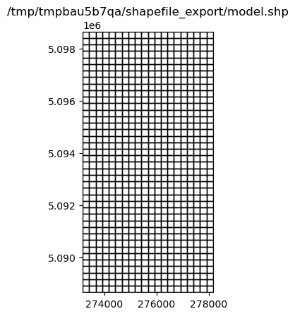
Export the whole model to a single shapefile
[7]:
fname = f"{outdir}/model.shp"
m.export(fname)
/home/runner/micromamba/envs/flopy/lib/python3.12/site-packages/flopy/export/shapefile_utils.py:307: UserWarning: Failed to get data for delc array, DIS package
  warn(
/home/runner/micromamba/envs/flopy/lib/python3.12/site-packages/flopy/export/shapefile_utils.py:307: UserWarning: Failed to get data for delr array, DIS package
  warn(
/home/runner/micromamba/envs/flopy/lib/python3.12/site-packages/flopy/export/shapefile_utils.py:307: UserWarning: Failed to get data for laycbd array, DIS package
  warn(
/home/runner/micromamba/envs/flopy/lib/python3.12/site-packages/flopy/export/shapefile_utils.py:307: UserWarning: Failed to get data for nstp array, DIS package
  warn(
/home/runner/micromamba/envs/flopy/lib/python3.12/site-packages/flopy/export/shapefile_utils.py:307: UserWarning: Failed to get data for perlen array, DIS package
  warn(
/home/runner/micromamba/envs/flopy/lib/python3.12/site-packages/flopy/export/shapefile_utils.py:307: UserWarning: Failed to get data for steady array, DIS package
  warn(
/home/runner/micromamba/envs/flopy/lib/python3.12/site-packages/flopy/export/shapefile_utils.py:307: UserWarning: Failed to get data for tsmult array, DIS package
  warn(
/home/runner/micromamba/envs/flopy/lib/python3.12/site-packages/flopy/export/shapefile_utils.py:307: UserWarning: Failed to get data for chani array, LPF package
  warn(
/home/runner/micromamba/envs/flopy/lib/python3.12/site-packages/flopy/export/shapefile_utils.py:307: UserWarning: Failed to get data for layavg array, LPF package
  warn(
/home/runner/micromamba/envs/flopy/lib/python3.12/site-packages/flopy/export/shapefile_utils.py:307: UserWarning: Failed to get data for laytyp array, LPF package
  warn(
/home/runner/micromamba/envs/flopy/lib/python3.12/site-packages/flopy/export/shapefile_utils.py:307: UserWarning: Failed to get data for layvka array, LPF package
  warn(
/home/runner/micromamba/envs/flopy/lib/python3.12/site-packages/flopy/export/shapefile_utils.py:307: UserWarning: Failed to get data for laywet array, LPF package
  warn(
[8]:
ax = plt.subplot(1, 1, 1, aspect="equal")
extents = grid.extent
pc = flopy.plot.plot_shapefile(fname, ax=ax, edgecolor="k", facecolor="none")
ax.set_xlim(extents[0], extents[1])
ax.set_ylim(extents[2], extents[3])
ax.set_title(fname)
[8]:
Text(0.5, 1.0, '/tmp/tmpbau5b7qa/shapefile_export/model.shp')
[9]:
fname = f"{outdir}/wel.shp"
m.wel.export(fname)
Export a package to a shapefile
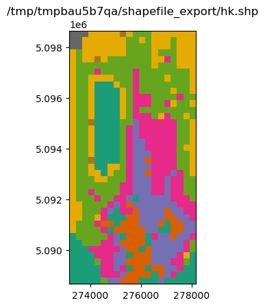
Export a FloPy list or array object
[10]:
m.lpf.hk
[10]:
<flopy.utils.util_array.Util3d at 0x7fa4fe596f30>
[11]:
fname = f"{outdir}/hk.shp"
m.lpf.hk.export(f"{outdir}/hk.shp")
[12]:
ax = plt.subplot(1, 1, 1, aspect="equal")
extents = grid.extent
a = m.lpf.hk.array.ravel()
pc = flopy.plot.plot_shapefile(fname, ax=ax, a=a)
ax.set_xlim(extents[0], extents[1])
ax.set_ylim(extents[2], extents[3])
ax.set_title(fname)
[12]:
Text(0.5, 1.0, '/tmp/tmpbau5b7qa/shapefile_export/hk.shp')
[13]:
m.riv.stress_period_data
[13]:
<flopy.utils.util_list.MfList at 0x7fa4fe50f200>
[14]:
m.riv.stress_period_data.export(f"{outdir}/riv_spd.shp")
MfList.export() exports the whole grid by default, regardless of the locations of the boundary cells
sparse=True only exports the boundary cells in the MfList
[15]:
m.riv.stress_period_data.export(f"{outdir}/riv_spd.shp", sparse=True)
[16]:
m.wel.stress_period_data.export(f"{outdir}/wel_spd.shp", sparse=True)
Ad-hoc exporting using recarray2shp
The main idea is to create a recarray with all of the attribute information, and a list of geometry features (one feature per row in the recarray)
each geometry feature is an instance of the
Point,LineStringorPolygonclasses inflopy.utils.geometry. The shapefile format requires all the features to be of the same type.We will use pandas dataframes for these examples because they are easy to work with, and then convert them to recarrays prior to exporting.
[17]:
from flopy.export.shapefile_utils import recarray2shp
combining data from different packages
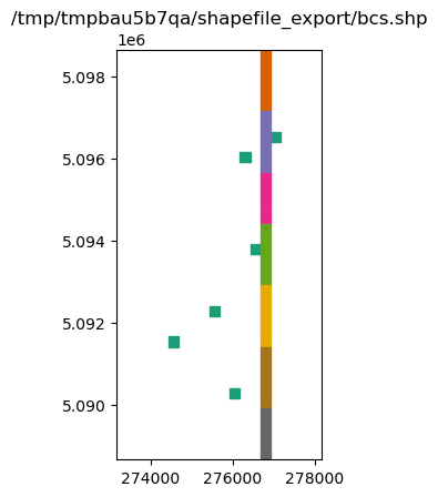
write a shapefile of RIV and WEL package cells
[18]:
wellspd = pd.DataFrame(m.wel.stress_period_data[0])
rivspd = pd.DataFrame(m.riv.stress_period_data[0])
spd = pd.concat([wellspd, rivspd])
spd.head()
[18]:
| k | i | j | flux | iface | stage | cond | rbot | |
|---|---|---|---|---|---|---|---|---|
| 0 | 0 | 8 | 15 | -0.00820 | 0.0 | NaN | NaN | NaN |
| 1 | 0 | 10 | 12 | -0.00410 | 0.0 | NaN | NaN | NaN |
| 2 | 0 | 19 | 13 | -0.00390 | 0.0 | NaN | NaN | NaN |
| 3 | 0 | 25 | 9 | -0.00083 | 0.0 | NaN | NaN | NaN |
| 4 | 0 | 28 | 5 | -0.00072 | 0.0 | NaN | NaN | NaN |
[19]:
from flopy.utils.geometry import Polygon

vertices = []
for row, col in zip(spd.i, spd.j):
    vertices.append(grid.get_cell_vertices(row, col))
polygons = [Polygon(vrt) for vrt in vertices]
polygons
[19]:
[<flopy.utils.geometry.Polygon at 0x7fa4fdfb4290>,
 <flopy.utils.geometry.Polygon at 0x7fa4fdfb51f0>,
 <flopy.utils.geometry.Polygon at 0x7fa4fdfb4fb0>,
 <flopy.utils.geometry.Polygon at 0x7fa4fdfb5370>,
 <flopy.utils.geometry.Polygon at 0x7fa4fdfb50a0>,
 <flopy.utils.geometry.Polygon at 0x7fa4fdfb4860>,
 <flopy.utils.geometry.Polygon at 0x7fa4fdfb5070>,
 <flopy.utils.geometry.Polygon at 0x7fa4fdfb46e0>,
 <flopy.utils.geometry.Polygon at 0x7fa4fdfb53d0>,
 <flopy.utils.geometry.Polygon at 0x7fa4fdfb5460>,
 <flopy.utils.geometry.Polygon at 0x7fa4fdfb54f0>,
 <flopy.utils.geometry.Polygon at 0x7fa4fdfb5550>,
 <flopy.utils.geometry.Polygon at 0x7fa4fdfb55e0>,
 <flopy.utils.geometry.Polygon at 0x7fa4fdfb5670>,
 <flopy.utils.geometry.Polygon at 0x7fa4fdfb56d0>,
 <flopy.utils.geometry.Polygon at 0x7fa4fdfb5760>,
 <flopy.utils.geometry.Polygon at 0x7fa4fdfb57f0>,
 <flopy.utils.geometry.Polygon at 0x7fa4fdfb5850>,
 <flopy.utils.geometry.Polygon at 0x7fa4fdfb58e0>,
 <flopy.utils.geometry.Polygon at 0x7fa4fdfb5970>,
 <flopy.utils.geometry.Polygon at 0x7fa4fdfb59d0>,
 <flopy.utils.geometry.Polygon at 0x7fa4fdfb5a60>,
 <flopy.utils.geometry.Polygon at 0x7fa4fdfb5af0>,
 <flopy.utils.geometry.Polygon at 0x7fa4fdfb5b50>,
 <flopy.utils.geometry.Polygon at 0x7fa4fdfb5be0>,
 <flopy.utils.geometry.Polygon at 0x7fa4fdfb5c70>,
 <flopy.utils.geometry.Polygon at 0x7fa4fdfb5cd0>,
 <flopy.utils.geometry.Polygon at 0x7fa4fdfb5d60>,
 <flopy.utils.geometry.Polygon at 0x7fa4fdfb5df0>,
 <flopy.utils.geometry.Polygon at 0x7fa4fdfb5e50>,
 <flopy.utils.geometry.Polygon at 0x7fa4fdfb5ee0>,
 <flopy.utils.geometry.Polygon at 0x7fa4fdfb5f70>,
 <flopy.utils.geometry.Polygon at 0x7fa4fdfb5fd0>,
 <flopy.utils.geometry.Polygon at 0x7fa4fdfb6060>,
 <flopy.utils.geometry.Polygon at 0x7fa4fdfb60f0>,
 <flopy.utils.geometry.Polygon at 0x7fa4fdfb6150>,
 <flopy.utils.geometry.Polygon at 0x7fa4fdfb61e0>,
 <flopy.utils.geometry.Polygon at 0x7fa4fdfb6270>,
 <flopy.utils.geometry.Polygon at 0x7fa4fdfb62d0>,
 <flopy.utils.geometry.Polygon at 0x7fa4fdfb6360>,
 <flopy.utils.geometry.Polygon at 0x7fa4fdfb63f0>,
 <flopy.utils.geometry.Polygon at 0x7fa4fdfb6450>,
 <flopy.utils.geometry.Polygon at 0x7fa4fdfb64e0>,
 <flopy.utils.geometry.Polygon at 0x7fa4fdfb6570>,
 <flopy.utils.geometry.Polygon at 0x7fa4fdfb65d0>,
 <flopy.utils.geometry.Polygon at 0x7fa4fdfb6660>]
[20]:
fname = f"{outdir}/bcs.shp"
recarray2shp(spd.to_records(), geoms=polygons, shpname=fname, crs=grid.epsg)
[21]:
ax = plt.subplot(1, 1, 1, aspect="equal")
extents = grid.extent
pc = flopy.plot.plot_shapefile(fname, ax=ax)
ax.set_xlim(extents[0], extents[1])
ax.set_ylim(extents[2], extents[3])
ax.set_title(fname)
[21]:
Text(0.5, 1.0, '/tmp/tmpbau5b7qa/shapefile_export/bcs.shp')
exporting other data
Suppose we have some well data with actual locations that we want to export to a shapefile
[22]:
welldata = pd.DataFrame(
    {
        "wellID": np.arange(0, 10),
        "q": np.random.randn(10) * 100 - 1000,
        "x_utm": np.random.rand(10) * 5000 + grid.xoffset,
        "y_utm": grid.yoffset + np.random.rand(10) * 10000,
    }
)
welldata.head()
[22]:
| wellID | q | x_utm | y_utm | |
|---|---|---|---|---|
| 0 | 0 | -1020.611454 | 274262.112298 | 5.097438e+06 |
| 1 | 1 | -958.179487 | 273573.374324 | 5.090025e+06 |
| 2 | 2 | -1056.787532 | 273742.834010 | 5.089790e+06 |
| 3 | 3 | -937.290038 | 273377.491403 | 5.090797e+06 |
| 4 | 4 | -1014.351523 | 276243.092790 | 5.098299e+06 |
[23]:
from flopy.utils.geometry import Point

geoms = [Point(x, y) for x, y in zip(welldata.x_utm, welldata.y_utm)]

fname = f"{outdir}/wel_data.shp"
recarray2shp(welldata.to_records(), geoms=geoms, shpname=fname, crs=grid.epsg)
[24]:
ax = plt.subplot(1, 1, 1, aspect="equal")
extents = grid.extent
pc = flopy.plot.plot_shapefile(fname, ax=ax, radius=100)
ax.set_xlim(extents[0], extents[1])
ax.set_ylim(extents[2], extents[3])
ax.set_title(fname)
[24]:
Text(0.5, 1.0, '/tmp/tmpbau5b7qa/shapefile_export/wel_data.shp')

Adding attribute data to an existing shapefile
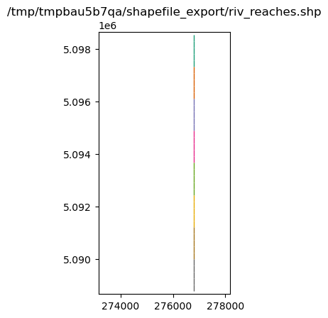
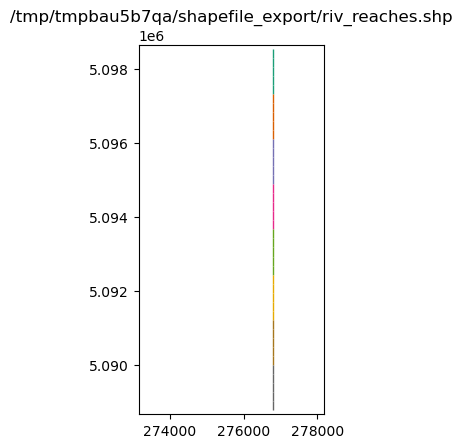
Suppose we have a GIS coverage representing the river in the riv package
[25]:
from flopy.utils.geometry import LineString

# make up a linestring shapefile of the river reaches
i, j = m.riv.stress_period_data[0].i, m.riv.stress_period_data[0].j
x0 = grid.xyzcellcenters[0][i[0], j[0]]
x1 = grid.xyzcellcenters[0][i[-1], j[-1]]
y0 = grid.xyzcellcenters[1][i[0], j[0]]
y1 = grid.xyzcellcenters[1][i[-1], j[-1]]
x = np.linspace(x0, x1, m.nrow + 1)
y = np.linspace(y0, y1, m.nrow + 1)
l0 = zip(list(zip(x[:-1], y[:-1])), list(zip(x[1:], y[1:])))
lines = [LineString(l) for l in l0]

rivdata = pd.DataFrame(m.riv.stress_period_data[0])
rivdata["reach"] = np.arange(len(lines))
lines_shapefile = f"{outdir}/riv_reaches.shp"
recarray2shp(
    rivdata.to_records(index=False),
    geoms=lines,
    shpname=lines_shapefile,
    crs=grid.epsg,
)
[26]:
ax = plt.subplot(1, 1, 1, aspect="equal")
extents = grid.extent
pc = flopy.plot.plot_shapefile(lines_shapefile, ax=ax, radius=25)
ax.set_xlim(extents[0], extents[1])
ax.set_ylim(extents[2], extents[3])
ax.set_title(lines_shapefile)
[26]:
Text(0.5, 1.0, '/tmp/tmpbau5b7qa/shapefile_export/riv_reaches.shp')
shp2recarray reads a shapefile into a numpy record array, which can easily be converted to a DataFrame
[27]:
from flopy.export.shapefile_utils import shp2recarray
[28]:
linesdata = shp2recarray(lines_shapefile)
linesdata = pd.DataFrame(linesdata)
linesdata.head()
[28]:
| k | i | j | stage | cond | rbot | iface | reach | geometry | |
|---|---|---|---|---|---|---|---|---|---|
| 0 | 0 | 0 | 14 | 20.100000 | 0.05 | 20.00 | 0.0 | 0 | <flopy.utils.geometry.LineString object at 0x7... |
| 1 | 0 | 1 | 14 | 19.870001 | 0.05 | 19.75 | 0.0 | 1 | <flopy.utils.geometry.LineString object at 0x7... |
| 2 | 0 | 2 | 14 | 19.650000 | 0.05 | 19.50 | 0.0 | 2 | <flopy.utils.geometry.LineString object at 0x7... |
| 3 | 0 | 3 | 14 | 19.420000 | 0.05 | 19.25 | 0.0 | 3 | <flopy.utils.geometry.LineString object at 0x7... |
| 4 | 0 | 4 | 14 | 19.190001 | 0.05 | 19.00 | 0.0 | 4 | <flopy.utils.geometry.LineString object at 0x7... |
[29]:
# make up some fluxes between the river and aquifer at each reach
q = np.random.randn(len(linesdata)) + 1
q
[29]:
array([-0.23449825,  2.44250502,  2.29170178,  2.01907546,  0.50027333,
        1.76590882,  0.54899661,  0.64360411,  0.41178483,  1.28733307,
        2.18641547,  1.03368788,  1.22797965,  2.41382103,  1.27559511,
        1.18183821,  1.93751404,  0.2330576 ,  0.12343977,  3.1020258 ,
       -0.41224456,  0.81233865,  1.40988834,  1.28263374,  1.8271038 ,
        0.09222863,  0.59686984, -0.01938138,  0.40656496,  1.66250638,
        0.16871723,  1.71724988, -0.61816848,  1.28037836,  1.72510896,
        1.07944819, -0.52232087,  0.54448826,  0.35181611,  0.13225717])
[30]:
linesdata["qreach"] = q
linesdata["qstream"] = np.cumsum(q)
[31]:
recarray2shp(
    linesdata.drop("geometry", axis=1).to_records(),
    geoms=linesdata.geometry.values,
    shpname=lines_shapefile,
    crs=grid.epsg,
)
[32]:
ax = plt.subplot(1, 1, 1, aspect="equal")
extents = grid.extent
pc = flopy.plot.plot_shapefile(lines_shapefile, ax=ax, radius=25)
ax.set_xlim(extents[0], extents[1])
ax.set_ylim(extents[2], extents[3])
ax.set_title(lines_shapefile)
[32]:
Text(0.5, 1.0, '/tmp/tmpbau5b7qa/shapefile_export/riv_reaches.shp')
Overriding the model’s modelgrid with a user supplied modelgrid
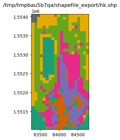
In some cases it may be necessary to override the model’s modelgrid instance with a seperate modelgrid. An example of this is if the model discretization is in feet and the user would like it projected in meters. Exporting can be accomplished by supplying a modelgrid as a kwarg in any of the export() methods within flopy. Below is an example:
[33]:
mg0 = m.modelgrid

# build a new modelgrid instance with discretization in meters
modelgrid = flopy.discretization.StructuredGrid(
    delc=mg0.delc * 0.3048,
    delr=mg0.delr * 0.3048,
    top=mg0.top,
    botm=mg0.botm,
    idomain=mg0.idomain,
    xoff=mg0.xoffset * 0.3048,
    yoff=mg0.yoffset * 0.3048,
)

# exporting an entire model
m.export(f"{outdir}/freyberg.shp", modelgrid=modelgrid)
No CRS information for writing a .prj file.
Supply an valid coordinate system reference to the attached modelgrid object or .export() method.
No CRS information for writing a .prj file.
Supply an valid coordinate system reference to the attached modelgrid object or .export() method.
/home/runner/micromamba/envs/flopy/lib/python3.12/site-packages/flopy/export/shapefile_utils.py:307: UserWarning: Failed to get data for delc array, DIS package
  warn(
/home/runner/micromamba/envs/flopy/lib/python3.12/site-packages/flopy/export/shapefile_utils.py:307: UserWarning: Failed to get data for delr array, DIS package
  warn(
/home/runner/micromamba/envs/flopy/lib/python3.12/site-packages/flopy/export/shapefile_utils.py:307: UserWarning: Failed to get data for laycbd array, DIS package
  warn(
/home/runner/micromamba/envs/flopy/lib/python3.12/site-packages/flopy/export/shapefile_utils.py:307: UserWarning: Failed to get data for nstp array, DIS package
  warn(
/home/runner/micromamba/envs/flopy/lib/python3.12/site-packages/flopy/export/shapefile_utils.py:307: UserWarning: Failed to get data for perlen array, DIS package
  warn(
/home/runner/micromamba/envs/flopy/lib/python3.12/site-packages/flopy/export/shapefile_utils.py:307: UserWarning: Failed to get data for steady array, DIS package
  warn(
/home/runner/micromamba/envs/flopy/lib/python3.12/site-packages/flopy/export/shapefile_utils.py:307: UserWarning: Failed to get data for tsmult array, DIS package
  warn(
/home/runner/micromamba/envs/flopy/lib/python3.12/site-packages/flopy/export/shapefile_utils.py:307: UserWarning: Failed to get data for chani array, LPF package
  warn(
/home/runner/micromamba/envs/flopy/lib/python3.12/site-packages/flopy/export/shapefile_utils.py:307: UserWarning: Failed to get data for layavg array, LPF package
  warn(
/home/runner/micromamba/envs/flopy/lib/python3.12/site-packages/flopy/export/shapefile_utils.py:307: UserWarning: Failed to get data for laytyp array, LPF package
  warn(
/home/runner/micromamba/envs/flopy/lib/python3.12/site-packages/flopy/export/shapefile_utils.py:307: UserWarning: Failed to get data for layvka array, LPF package
  warn(
/home/runner/micromamba/envs/flopy/lib/python3.12/site-packages/flopy/export/shapefile_utils.py:307: UserWarning: Failed to get data for laywet array, LPF package
  warn(
And for a specific parameter the method is the same
[34]:
fname = f"{outdir}/hk.shp"
m.lpf.hk.export(fname, modelgrid=modelgrid)
No CRS information for writing a .prj file.
Supply an valid coordinate system reference to the attached modelgrid object or .export() method.
[35]:
ax = plt.subplot(1, 1, 1, aspect="equal")
extents = modelgrid.extent
a = m.lpf.hk.array.ravel()
pc = flopy.plot.plot_shapefile(fname, ax=ax, a=a)
ax.set_xlim(extents[0], extents[1])
ax.set_ylim(extents[2], extents[3])
ax.set_title(fname)
[35]:
Text(0.5, 1.0, '/tmp/tmpbau5b7qa/shapefile_export/hk.shp')
[36]:
try:
    # ignore PermissionError on Windows
    temp_dir.cleanup()
except:
    pass